
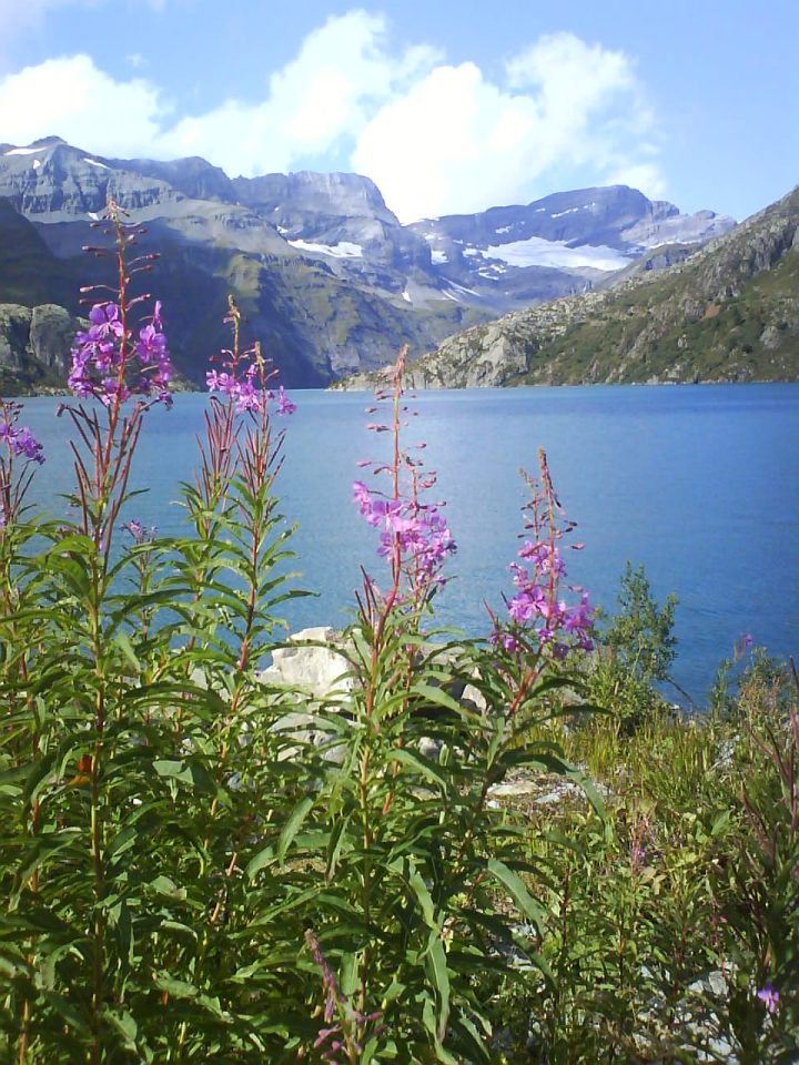
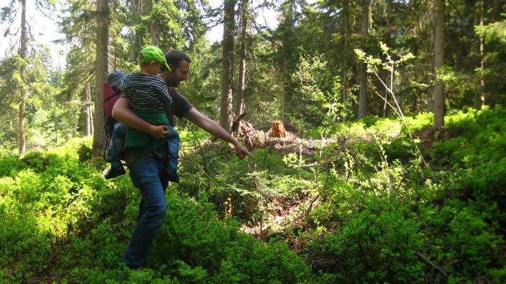
With a now 12 year old and a 9 year old in tow, the MBFF family is beginning to find its 🏔 hiking mojo (mostly!).
Here, below, you will find some of our favourite (and tried and tested!) family hikes 🏔 au Pays du Mont-Blanc, with suggestions for 🥤 buvettes and 🏚 refuges for a snack, lunch or overnight!
[ ⇒ for 🏔 general tips on hiking with small children see MBFF article: 🏔 FAMILY HIKES – tips for hiking with small children ]
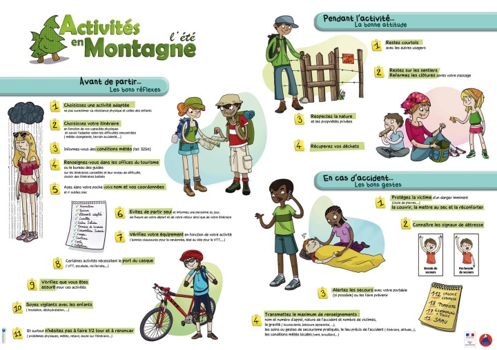
⚠️ SAFETY NOTE FOR HIKING: before setting out on a mountain hike (en famille or otherwise), always :
- ✅ check the météo;
- ✅ make sure you pack the correct equipment for emergency situations as well as the basics for a mountain hike : medical kit, sufficient food and water, sun protection, warm and waterproof clothing, emergency blanket, head-torch, correct maps, emergency whistle, compass and emergency rescue number for your charged mobile phone;
- ⚠️ be especially vigilant with small children during the hike – children sitting in backpacks need extra protection from the ☀️ glare of the sun (sunhats, sunglasses, sun lotion, shade attachment for baby-carrier or backpack). Also, do not let small children run off ahead and hold their hand where there are sheer drops (or unknown terrain);
For information regarding 🏚 Refuges en Famille in Savoie Mont-Blanc see website Refuges en Famille or browse the pdf leaflet.
[ SUMMER 2022 important update – the devastating ⛈ storms of early July 2019 caused extensive damage to 🌲 forest and woodland 🏔 au Pays du Mont-Blanc, especially in the Arve Valley. Before heading off for a forest walk, for safety reasons you should check with local tourist offices to see if the footpaths are accessible! If stopping at 🥤 a buvette or 🏚 refuge, be sure to check 2022 regulations (booking requirements, etc . . . ]
Colour code for listings:
Chamonix Valley (Chamonix, Argentière, Les Houches, Servoz) & Vallorcine
Passy & environs
Sallanches, Combloux, Cordon & Domancy
Saint-Gervais-les-Bains, Le Fayet & environs
Megève, Praz-sur-Arly & environs
Les Contamines & environs
🇫🇷 Further France
🇨🇭 Switzerland
Chamonix Valley
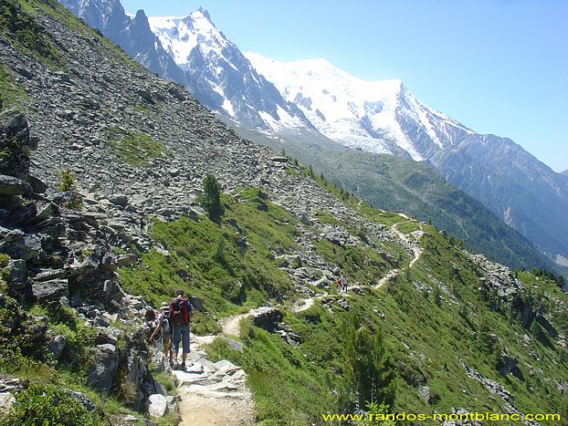
Plan de l’Aiguille ⇒ Montenvers Mer de Glace traverse (Chamonix)
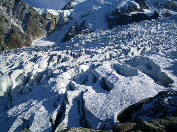
If you are visiting Chamonix for the first time, or showing off the highlights to visitors, you or they are likely to want to head up the 🏔🚠 Aiguille du Midi, on the iconic cable car. If you have competent walkers in your group, a great way to do two destinations in one swoop is to embark on the hike from the mid-station of l’Aiguille du Midi (Plan de l’Aiguille) across to the ❄️ Montenvers Mer de Glace (🏔 Le Sentier des Aiguilles de Chamonix, along the Grand Balcon Nord – this hike is effectively a traverse, so not too challenging!). From Montenvers, you can take the 🚂 iconic cog train back down to Chamonix.
departure point: 🚠 Téléphérique Aiguille du Midi – check hours! / 🅿️ parking: 🅿️ Parking du Grépon (see here) / 🚞 train or bus stop: Chamonix – Aiguille du Midi / max altitude: 2317m (Plan de l’Aiguille) / distance: 7km / duration: 2,5h walk / more information;
🥤 buvettes options: Refuge Plan de l’Aiguille (and if walking back down from ❄️ Montenvers Mer de Glace, then you have the Buvette des Mottets and Buvette de Caillet);
[ good to know: a short walk down from the Plan de l’Aiguille will take you to the pretty 💦 Lac Bleu ]


Lac Blanc ⇒ Lacs des Cheserys boucle (Les Praz / Flégère)
This iconic Chamonix hike really is perfect for families with older children . . . set within the ⛰ Réserve Naturelle des Aiguilles Rouges, the views upon arrival at 💦 Lac Blanc are superb: les Aiguilles de Chamonix, Les Drus, L’Aiguille Verte, les Grandes Jorasses and the glaciers. This hike can be done as a boucle, if using the new 🚡 Télécabine de la Flégère (thus avoiding a steep ascent or descent), or a beautiful trail leaves from the ⛰ Col des Montets [ alternative departure points: from Argentière (🅿️ Parking du Grands-Montets) and from Tré-Le-Champ (🅿️ parking side of road) ]. There are some very steep sections and some metal ladders on the section between 💦 Lac Blanc and 💦 Lacs des Cheserys, so do keep an eye on children – but this does also add to the fun of the walk!
[ good to know: at the end of the walk, it can be rewarding to head to the 💦 Paradis des Praz (10 minute walk from Télécabine de la Flégère), to refresh your feet in the gurgling stream! ]
🅿️ departure point & parking: 🚡 Télécabine de la Flégère (Les Praz) – check hours! / 🚞 train or bus stop: Les Praz de Chamonix / max altitude: 2352m (Lac Blanc) / distance: 7,5km / duration: 5h walking (with lunch break) / more information;

Chalet la Floria ⇒ Les Praz (Chamonix / Les Praz)
This is one of the first short hikes I ever did when I first moved to Chamonix, and it is a walk that never loses its charm for me. It is the perfect distance for families with a baby-carrier or backpack, or with children of a walking age. From Chamonix, the route starts off from the pretty village of Les Nants and heads up fairly steeply through the 🌲 shady forest and onto the Petit Balcon Sud. Upon arrival at the colourful 🌷 Chalet la Floria (named after the hundreds of flowers adorning the mountain chalet, spilling out of pots and window boxes), you can have a refreshing drink and snack, with beautiful views of the 🏔 Aiguilles de Chamonix. The return route of this hike is via Les Praz (a steeper downhill), or you can shorten the hike by taking the same route back down to Les Nants (if you go down to Les Praz, you can either stroll beside the 💦 Arve river back to Chamonix, or take the train or bus).
[ good to know: if you head down to Les Praz, be sure to stop of at the lovely, bucolic 🏞 Paradis des Praz, to dip your feet in the refreshing stream and have an ice-cream! (see here for MBFF article) ]
departure point: Chamonix (Les Nants) / 🅿️ parking: Parking du Savoie or St-Michel / 🚞 train or bus stop: Chamonix centre / max altitude: 1330m (La Floria) / distance: 7,5km / duration: 4h (with refreshment break) / more information;
La Jonction (Les Bossons)
Another iconic Chamonix hike, this one is not for the faint-hearted; there is a scrambling section at the top, and this is a full and long day’s hike! I would only recommend it for families with older children and very competent walkers . . . this is not a hike for little ones!
“ La Jonction is the last rocky spur before the kingdom of ice. ” (quote from OT Chamonix), and this hike takes you in the footsteps of the guide J. Balmat and Dr. Paccard, in the first ascent of 🏔 Mont-Blanc in 1786!
This is one of the first longer hikes I did when I first moved to Chamonix, and I loved it so much that I then opted to take friends when they came to visit. You get it all on this route: 🌲 forest paths, the historic Gîte à Balmat rock, some scrambling, and finally an up close and personal meeting with ❄️ glaciers and their seracs and crevasses (❄️ Glacier des Bossons and ❄️ Glacier du Taconnaz) . . . and, of course, 🏔 majestic views of Mont-Blanc, l’Aiguille du Midi, le Dôme du Goûter and les Aiguilles Rouges . . . Along the way are 🥤 two buvettes: the Chalet du Glacier des Bossons and the Chalet des Pyramides.
[ good to know: a shorter walk with little ones in tow can be taken instead to the ☕️ Chalet du Glacier des Bossons (using the télésiège, which is fun for children! / ⇒ see MBFF article here ]
🅿️ departure point & parking: 🅿️ Parking Glacier des Bossons / 🚞 train or bus stop: Les Bossons / max altitude: 2589m (La Jonction) / distance: 13km aller-retour / duration: 8h, a full day! / more information;


L’Alpage de Charousse (Les Houches)
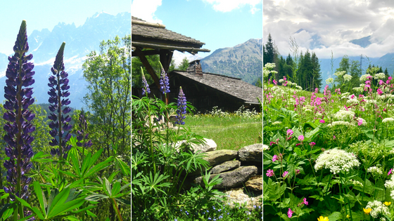
This 🌷 meadow walk in Les Houches (a « glacial field ») is one of my favourite walks in the Chamonix Valley, and one that we have really enjoyed en famille with two small walkers. The walk is easy, the distance is perfect for young hikers, there are suitable picnic spots and great 📷 photo opportunities: lupins in May & June, 🏚 rustic old farmhouses, 🏔 magnificent views of the Aiguilles de Chamonix and Chaîne des Fiz! 🏚 Five renovated farms make up the mountain meadow of Charousse and 🌷 blue and purple lupins and other wild flowers abound. You can start this hike at the 🚡 Télécabine du Prarion, or you can park a bit closer at 🅿️ Parking de la Côte, if you have less able or younger walkers. From the 🚡 Télécabine du Prarion, you head up the quiet, residential route des Chavants (a few little shortcuts take you off the road) and then up onto chemin de Charousse . . . this walk is a boucle, or – if you have more competent walkers – you can extend the hike up to Prarion and take the 🚡 télécabine back down;
[ ⇒ for more information about this hike, see MBFF article ]
good to know – after this short hike, you can enjoy what the 💦 Lac des Chavants has to offer (small lake, refreshments at La Guinguette, playground, orienteering parcours) . . . or head to the lovely Hôtel Aiguille du Midi in Les Bossons for a drink in its lovely gardens;
departure point: 🚡 Télécabines du Prarion, Lac des Chavants or closest at 🅿️ Parking de la Côte / 🅿️ parking: closest car park at La Côte / nearest train station: Les Houches SNCF / max altitude: 1260m / duration: 2,5h (with long picnic stop);
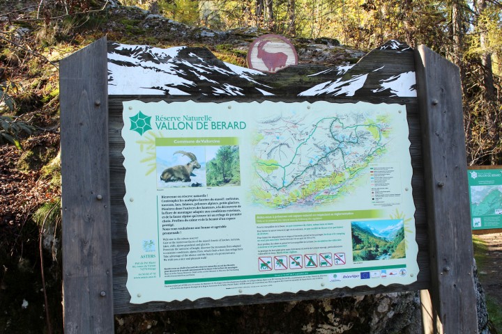
Cascade de Bérard (Vallorcine)
This is a very short hike, perfect for small walkers or families with baby-carriers or backpacks. Equally, with older and more competent hikers, the hike can be extended along the Vallon de Bérard and up to the 🏚 Refuge Pierre à Bérard, where you might be rewarded with some views of marmots or ibexes (bouquetins). The walk starts just opposite the train station in Le Buet, next to l’Hôtel du Buet; you then hike past the pretty 🏚 hamlet of La Poya (beginner ski area in winter; there is a great parcours d’orientation here). There are shady paths along the way, and look out for some wooden sculptures in the grassy meadow and in the forest . . . and once arrived at the 💦 Cascade de Bérard (which is really impressive – you can get really close to the waterfall on the metal walkway!) you can relax at the 🥤 Buvette Cascade de Bérard.
[ ⇒ for more information about this hike, see separate MBFF article ]
good to know: when open, don’t forget to stop off at the Grotte à Farinet, which is located behind the Refuge de Bérard – there is a fascinating story attached to this little cave!


🅿️ departure point & parking: Le Buet / 🚞 train or bus stop: Le Buet SNCF / max altitude: 1420m (Cascade de Bérard) / distance: 2km aller-retour / duration: 45mins aller-retour;


[ ☕️ BUVETTE HIKES CHAMONIX VALLEY – here are some other short hikes that include a stop at a scenic buvette (perfect for young hikers or baby carriers): 💦 Cascade du Dard buvette (waterfall), ❄️ Cabane du Cerro (glacier views), 🥤 Buvette des Mottets, 🥤 Buvette du Caillet, 🍰 Chapeau Lavancher (great cakes!), 🥤 La Crèmerie (Argentière), 🥤 Tête de la Fontaine (Servoz) . . . seeℹ️Chamonix Tourisme for more information about all of these hikes ]
Refuge de Loriaz via Emosson dam (Vallorcine)
This is a wonderful all-day hike, perfect for families with older children or competent walkers (not for small children), as there are little sections of cables. The hike can also be extended for more competent hikers: right round the 🇨🇭 two dams at Emosson (💦 Lac d’Emosson and 💦 Lac du Vieux Emosson), past 🦕 dinosaur prints (!) and then up and over the Col de la Terrasse (2648m), down to an overnight at the lovely ☕️ Refuge de Loriaz (2020m). There are also alternative, shorter routes up to Loriaz, from Vallorcine, Le Couteray or Le Siseray. This chosen hike starts from Vallorcine, heads to the hamlet of Barberine (a popular canyoning area), up to 💦 Lac d’Emosson (lovely picnic spot), and then from the Col du Passet to the 🏚 Refuge de Loriaz, there is a short cable section (not requiring gear). From Loriaz, there are various routes back down to Vallorcine;
☀️ good to know – in the summer, you can visit the Maison de Barberine;
☕️ good places to eat in Vallorcine at the end of the day’s hike – Le Café Comptoir, L’Arrêt Bougnête at Vallorcine SNCF and La Ferme des 3 Ours;
🅿️ departure point & parking: Vallorcine SNCF / 🚞 train or bus stop: Vallorcine SNCF / max altitude: 2020m (Loriaz) / duration: 7 to 8 hours, with breaks / more information;


Passy & environs
Lac Vert (Plaine-Joux) via the Passerelle Himalayenne
💦 Lac Vert (MBFF article here) up at Plaine-Joux / Servoz – formed by rockfall from the Dérochoir – is beautiful at any time of the year, and it is just as lovely to visit with raquettes during the ❄️ snowy winter months as it is to enjoy the reflection of 🍂 autumn leaves in its emerald waters, or the green, green, green of spring and summer! Surrounded by 🌲 spruce pines, the loop around the small lake is a fun scramble for able little walkers, with rocks and little bridges to cross (though please do hold onto hands, as the rocks are sharp and there are many tree roots to stumble over!). You might see the odd person 🎣 fishing while here. The ☕️ Restaurant du Lac Vert is a lovely spot to stot and admire 🏔 Mont-Blanc (with a new terrace as of 2018!) and there are restaurants up at Plaine-Joux (where you can also watch the parapentistes take off!). This walk can be lengthened if you start off from Servoz, or do a boucle up to the ☕️ Refuge du Châtelet d’Ayères (see MBFF article ⛷ Plaine-Joux Skiing for more information about snow-shoe routes).
MBFF’s favourite hike up to 💦 Lac Vert is from the 🌉 Passerelle Himalayenne in Plateau d’Assy. These days (unless mobilité réduite), you have to park at Place Tobé in Plateau d’Assy, from where you walk through the 🌲forest for about 30mins to get to the bridge. From the bridge up to 💦 Lac Vert is a further 45mins, and the views of Mont-Blanc along the way are fabulous! (there are alternative hikes from Servoz)
[ ⇒ for more information about the hike to 💦 Lac Vert from the 🌉 Passerelle Himalayenne, see separate BFF article here ]
good to know – from late spring until early autumn, you can visit the lovely 🌻 Jardin des Cimes on your return journey!
departure point & parking: Place Tobé (Plateau d’Assy), or for less able walkers, park at Lac Vert itself (only possible out of main season, and NOT possible over the winter season!), or park at Plaine-Joux and hike down to the Lac Vert (or take a navette in summer) / 🚞 train or bus stop: Plaine-Joux navettes / max altitude: 1270m (Lac Vert) / distance: 6km aller-retour / duration: 2h30 boucle from Place Tobé or 1h boucle from Plaine-Joux / more information;
⚠️ note for summer 2022: you CANNOT park at Lac Vert – instead, there are regular navettes from Plaine-Joux!

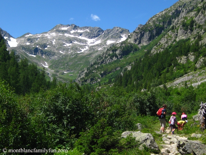
Lac de Pormenaz (Passy / Servoz)
This day hike to 💦 Lac de Pormenaz was one of the first longer family hikes with a baby backpack that we did (and when I first discovered that my hiking books no longer fitted properly, since pregancy had changed the shape of my feet!). As well as a lovely picnic stop at the 💦 Lac de Pormenaz (where MBFF daddy took a summer dip!), we had a refreshment stop at the 🥤 Refuge de Moëde Anterne (an old chalet from 1898 originally used by chamois hunters, its cantine was used to hide resistant fighters during WWII!), where our then 1,5 year old had a play in the sandpit! The 💦 Lac de Pormenaz is located within the 🏔 Réserve Naturelle de Passy, with imposing views of the ⛰ Chaîne des Fiz, Les Aravis and the Pointe Noire. For our hike, we parked just after the 🥤 Refuge Châtelet d’Ayères (the road leaving from past the téléski), but due to rockfall on the road to the Refuge Châtelet d’Ayères, you are now obliged to park at Plaine-Joux (note: parking at Lac Vert over the summer months in no longer permittted!), which adds another hour to your hike; this hike therefore requires stamina. From here, we walked towards 🏚 les Chalets d’Ayères and then took the TMB route to get to 💦 Lac de Pormenaz; you can do a boucle, coming back via La Chorde (this route is steep, with metal ladders and cables, so not suitable for very young walkers), or you can retrace your footsteps along the TMB sentier (or head up La Chorde and back down the TMB sentier).
🅿️ departure point & parking: Plaine-Joux, Lac Vert or Le Souay (Servoz) / 🚞 train or bus stop: Servoz SNCF or Plaine-Joux navettes / max altitude: 2002m (Refuge de Moëde-Anterne) / duration: 7 hours, with lunch & refreshment stops / more information;


Sallanches, Combloux & Cordon
« Le Sapin Président » / Refuge de Véran (Sallanches)
🌲 Le Sapin Président is an ancient tree (269 years old on the most recent sign!), and the short walk to get there is the ideal opportunity for families to explore the forest. The path is mainly in the shade, so perfect for a hot summer’s day. To reach the start of this walk en voiture, from Saint-Martin in Sallanches, take the route de Reninge up to the 🅿️ Parking du Grand Arvet and then follow the signs towards Véran (equally, for older children or more able walkers, you can extend the hike up to 🏚 the Refuge de Véran, run by volunteers of the CAF). This is a beautiful alpage.
dimensions of the 🌲 Sapin Président: 47m high and 4,10m circumferance;
🅿️ departure point & parking: 🅿️ Parking du Grand Arvet / 🚞 nearest train station: Sallanches SNCF / max altitude: 1080m (Le Sapin Président) / distance: 2km aller-retour / duration: 1,5 hour aller-retour (with lunch stop at Le Sapin Président) / more information: here;


Lacs des Ilettes, Cascade de l’Arpenaz & Luzier (Sallanches)
I love this relatively flat walk from 💦 Lacs des Ilettes up to the Cascade d’Arpenaz and back via Luzier; it is varied and has lots of little surprises along the way. It can also be done by 🚵♀️ VTT (though I’m personally not very confident over tree roots!) and there are some geocaches along the way . . . The walk commences at the third lake at 💦 Lacs des Ilettes (nature reserve / MBFF article here), and then follows the 💦 Arve river for a while, past fields and then across the road to 💦 Cascade de l’Arpenaz (270m high and a popular picnic spot / see MBFF article here) . . . from here, you head up into the 🌲 forest, and then down through the village of Luzier and then back down to Lacs des Ilettes;
[ good to know – you can have a cold dip at the 💦 Cascade de l’Arpenaz or you can dip your feet or have a swim in the swimming lake at Lacs des Ilettes . . . or stop for refreshments at 🥤 Le Transat (summertime only and great pizzas now available);
[ ⇒ to read about this easy hike in more detail, see separate MBFF article here ]
🅿️ departure point & parking: 🅿️ Lacs des Ilettes (3rd lake) / 🚌 train or bus stop: Sallanches SNCF (navettes in summer);


Refuges of Mayères, Tornieux & Doran (Sallanches)
There are several hiking options to the fabulous 🏔 mountain refuges of Mayères (1563m), Tornieux (1450m) or Doran, up above Sallanches. The walks head up through 🌲 forest (though the direct walk to Doran has a large section along the 4×4 road), and there is the option of doing the longer boucle from Mayères or Tornieux over to Doran. If you aim to have lunch or spend the night at any of the refuges, be sure to book ahead! I particularly like the hike that starts at Lintre, and takes you past the Pierre Fendue and the 💦 Cascade des Fours, before arriving at Tornieux or Mayères / ⇒ see Sallanches Tourisme for more information (there are several guided walk options over the summer months).

[ ⇒ for more information about the Lintre – Pierre Fendue – Tornieux hike, see separate MBFF article here ]
🅿️ departure point & parking: 🅿️ Burzier or Lintre or Plan Chevalier (for Doran) / 🚌 train or bus stop: Sallanches SNCF (navettes to Burzier in summer) / more information: Sallanches Tourisme;


« Sur les traces des graniteurs » (Combloux)
This is a themed walk, perfect for families, which takes you into the 🌲 forest and to huge blocks of granite (deposited 15,000 years ago, when the glacier receded), and the vestiges of the old quarries, with their ramps, slides and winches . . . the granite workers of yesteryear! From the Tourist Office in Comboux, you take the chemin de la Promenade (next to Agence Silvain), and then you head towards the 🏚 Ferme à Isidore (an 18th century farmhouse, where there are sometimes temporary exhibitions), and then you follow the signs to the start of the boucle. Alternatively, you can park in the industrial zone, right at the start of the hike.
[ good to know – being a short walk, this gives you ample time to explore all that Combloux has to offer families: a 🚲 pumptrack with a view (pack bikes, scooters and footballs and basketballs in the boot of your car!), superb 🌈 playgrounds, the 💦 Plan d’Eau Biotope naturally purified lake (currently being re-landscaped), and lovely restaurants ]
🅿️ departure point & parking: Combloux village or industrial zone (limited parking here) / train or bus stop: 🚞 Sallanches SNCF (then SAT buses) / max altitude: 980m (departure point, Combloux) / distance: 1km / duration: 1,5 hours (time to read panels and explore) / more information;


« Forest Discovery Trail » boucle (Cordon)
The 🌲 « Forest Discovery Trail » in Cordon is a lovely 1 hour loop in woodland. Being in the forest, it is the perfect family hike on a hot summer’s day, and there is a 🍏 lovely picnic spot at the departure / arrival point!
departure point: just below picnic area Les Plaines / parking: 🅿️ Parking des Plaines (no tarmac on road above Lezaive d’en Haut) / max altitude: 1400m / distance: 1km / duration: 1 hour (time to read panels) / more information / NB – if hiking early in the season, please check with Cordon Tourisme to see the state of the route (winter landfall);
[ ⇒ for more information about this super family hike, see separate MBFF article here ]


La Pesse & Médonnet boulders (Nant-Cruy & Médonnet)
These are very, very 🌲 short walks in Nant-Cruy or Médonnet, but worth a mention as both are magical locations (we call them our “magic woods”) and offer plentiful opportunity for exploration and cabane-making in the forest. Both are effectively 🧗♂️ mini-Fontainebleaus, and areas known to boulderers. We go to both spots regularly, and spend lovely moments building cabanes in the forest, climbing the granite boulders and enjoying the fairy-like and very special atmosphere!
[ ⇒ for more informtion about our magic woods, see MBFF article here ]
good to know: you can incorporate 🧗♂️ La Pesse boulders into a proper uphill hike by starting from the footpath by the Crédit Agricole in Sallanches (opposite La Grenette); ⇒ see MBFF article here!
also good to know – the nearby ⛪️ Chapelle du Médonnet was built in 1637 and served as a quick escape for locals from the 🐺 wolves in the area!
departure point for La Pesse boulders: route de Nant Cruy, La Pesse footpath; 🅿️ parking: route de Nant Cruy (a few parking spots on the road, just past the La Pesse footpath) / 🅿️ parking for Médonnet boulders: a lay-by on route de Médonnet / duration: short easy 10mins walk aller-retour, and then plenty of time to play and explore!


Saint-Gervais-les-Bains & environs
« Sur la Piste de Charlotte la Marmotte au Bettex » (Saint-Gervais-les-Bains)
« Sur la Piste de Charlotte la Marmotte au Bettex » runs from le Bettex to les Communailles, and the big attraction is that you can do this family hike with a buggy! Not that our family uses a buggy anymore, but I wish I’d known about this walk when we did! To start this family hike, which is dotted with 6 informative panels along the way, you will need to take the 🚡 Télécabine du Bettex, or park up at the arrival station of the Télécabine du Bettex / MBFF did this hike a couple of winters ago, and we loved it!
[ ⇒ to read in more detail about our experience on this hike, see separate MBFF article here ]
good to know – enjoy the new fresques of 2KM3 at 🚡 the télécabine! / there is a playground at Le Bettex in summertime, and Saint-Gervais-les-Bains centre has a fabulous playground; a perfect stop after this hike!
🅿️ departure point & parking: 🅿️ Télécabines du Bettex (arrival station) / max altitude: 1421m (Communailles) / duration: 2 hour aller-retour / more information;

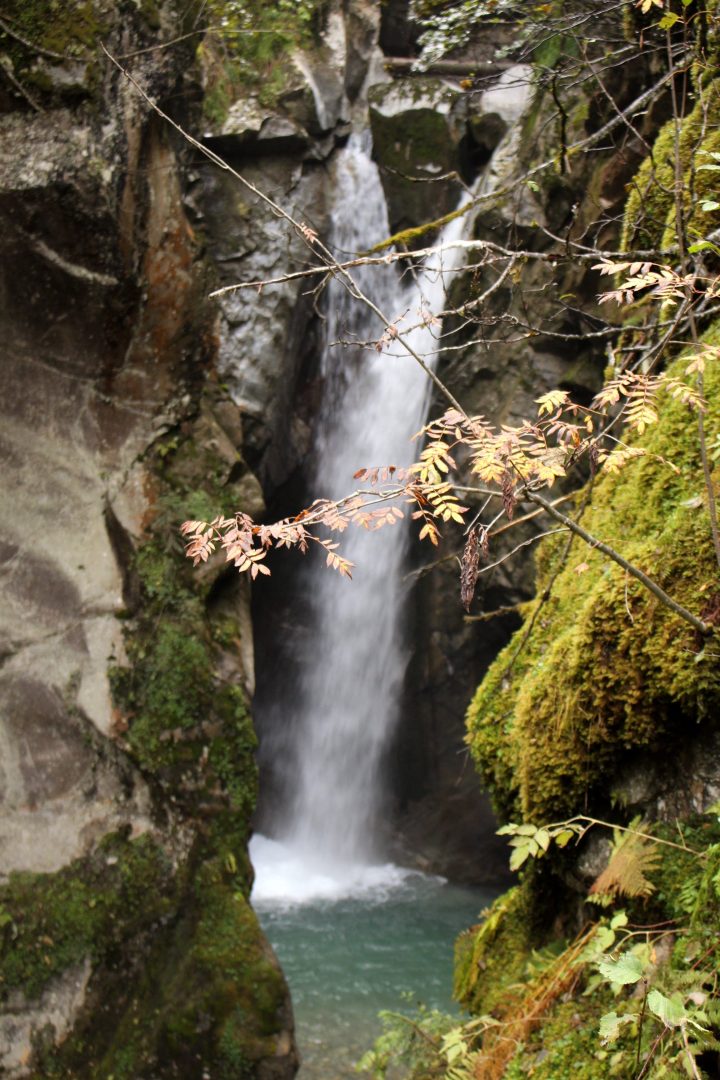
Les Gorges de La Gruvaz (La Gruvaz)
This is a hike that we discovered just last springtime and we loved it! I don’t think it is talked about enough! It is a short and fairly easy hike up to 1280m, a 40mins hike up 💦 the Torrent de Miage, for a lovely view down on the gorges / you can play in the water at the start of the hike, but with due caution, obviously;
good to know: for some more ideas for 💦 waterfall and gorges hikes locally, see separate MBFF article here;
🅿️ parking & departure point: 🅿️ Parking de la Gruvaz (just off the road between Saint-Gervais and Les Contamines-Montjoie) / max altitude: viewing platform (1120m) / duration: about 40mins up, 30mins down;


Champel or La Gruvaz ⇒ Refuge de Miage (with a Mont-Truc optional “summit”)
I love this walk as you get to do ⛰ a little “summit” (Mont-Truc) and the scenery is lovely: streams, verdant pastures, marmots, the glaciers of the 🏔 Dômes de Miage. It is an ideal family walk and you can add to the excitement by adding a refuge night at 🏚 Refuge de Miage (there are some private cabins). The hike can be done either as an aller-retour on the TPMB sentier, or as a boucle, via the Chalets du Truc and La Gruvaz. Equally, there are much more difficult boucles (like the one over the Col du Tricot at 2120m) for older children and more competent walkers, and access is also possible from Les Contamines-Montjoie.
🅿️ departure point & parking: 🅿️ Parking la Gruvaz (1120 m) or Champel / max altitude: Refuge de Miage (1560m) and Mont-Truc (1811m) / duration: about 5 hours with lunch stop and Mont-Truc summit / more information: randonneespourpetitsetgrands.com;


Megève & Praz-sur-Arly
Le Calvaire & le Creux Saint-Jean boucle (Megève)
MBFF discovered this hike last springtime, and we absolutely loved it! It is really accessible for families and is really varied! You start at ⛪️ the Calvaire, where you can explore the chapels and the ermitage, and then you head down into 🌳 the forest on the Sentier Nature du Calvaire (a parcours ludique, with lots of informative panels about nature & patrimoine!) . . . you arrive at 💦 the Creux Saint-Jean, a bucolic spot, with a waterfall, stream and small stone bridge. Once out of the forest, you head down chemin de Maz, back into the old part of Megève. You could also extend this hike a further 30mins UP (and then DOWN – and be warned, there are metal steps and cables!) to the 💦 Cascade de la Belle des Bois.
good to know: there is an ExploreGame you can do on your smartphone along the hike – see here;
departure point & parking: 🅿️ Parking du Casino / duration: 2 hours walking (breaks included) / more information;
 © montblancfamilyfun.com")
 © montblancfamilyfun.com")
 © montblancfamilyfun.com")
 © montblancfamilyfun.com")
 © montblancfamilyfun.com")
 © montblancfamilyfun.com")
 © montblancfamilyfun.com")


 © montblancfamilyfun.com")
 © montblancfamilyfun.com")

 © montblancfamilyfun.com")
« Le Chemin des Contrebandiers » (Praz-sur-Arly)
« Le Chemin des Contrebandiers » is a themed walk aimed at older children (from 9 years). The excitement of the walk starts with a chairlift (télésiège Crêt du Midi), wich is open every day in the summer (except Mondays and Fridays) from 10h to 16h30. The 📚 BD (bande dessinée) that accompanies this family hike & treasure-hunt is available for 5€ from the Tourist Office; armed with this, you then head off to find the treasure of Fanfouétomas, the famous contrebandier (smuggler) from Praz-sur-Arly, following clues along the way!
🅿️ departure point & parking: 🅿️ télésiège Crêt du Midi / max altitude: 1980m / duration: 2 hours walking (breaks not included) / more information;


Les Contamines-Montjoie & environs
Les Ânes et les Mômes – hiking with donkeys (Notre-Dame-de-la-Gorge)
A couple of summers ago, we discovered a lovely way to encourage our sons to hike . . . walks accompanied by a donkey! A friend had recommended to me Les Ânes et Les Mômes . . . the idea is to lead a donkey on a walk . . . and, if necessary, to let the children take turns on the donkey’s back. This company has different lengthed options (even some over-nighters!) and we opted for the shortest hike (15€ for 1h30). The boys absolutely loved the experience (though they did, inevitably, squabble about whose turn it was on the donkey’s back), and it was definitely a great incentive to keep Big Brother walking and to give Daddy a rest from Little Brother shoulder duty! Our donkey’s name was Ernest, and he became a firm friend; we still talk fondly of him!
departure point: Les Ânes et les Mômes in Notre-Dame-de-la-Gorge (Parc de Loisirs du Pontet) / parking: 🅿️ Télécabines de la Gorge or cross-country ski entrance car park / max altitude: depends on hike / distance: depends on hike / duration: 1h30 to 5 days! / more information;


🐺 good to know – another animal-themed option for hiking is the sport of canirando, which has become very popular au 🏔 Pays du Mont-Blanc in recent years. Companies offering canirando au Pays du Mont-Blanc: 🐺 3D Nordic (Flumet) – you can also visit their kennels / 🐺 Huskydalen (Chamonix) / 🐺 Au Mont du Villard du Nord (Megève) / 🐺 Voyageurs d’Hiver (Les Contamines-Montjoie);
Notre-Dame-de-la-Gorge up to Refuge de Nant Borrant, la Cascade de la Combe Noire or Lacs Jovets (Notre-Dame-de-la-Gorge)
We have been doing this short hike with our boys since they were very small – first they sat in the baby backpack, and then they demanded to walk! For some reason, our boys have seemed to complain less when the ascent is steep (as opposed to flat terrain!) and this walk is certainly very steep! There are some lovely highlights en-route to the ☕️ Refuge du Nant Borrant (we have overnighted here en famille): 💦 torrents, the pont naturel, the pont romain . . . beyond the 🏚 Refuge du Nant Borrant, you head towards Chenalettaz, from where you follow the path to l’Anéry back down to Notre-Dame-de-la-Gorge (steep!!!). You can also take the same route back down the Roman road, which is easier. For very competent walkers, the hike can be extended up to 💦 Lacs Jovets (2174m) – this is a full day’s hike.
good to know: there are a couple more refuges on the way up to💦 Lacs Jovets , which make the longer hike more accessible over 2 days for children: Refuge des Prés (new) and Refuge de la Balme;
Another option, is to head off towards 💦 the Cascade de la Combe Noire, from the refuge – this is a really worthwile detour!
also good to know – after the hike, you can enjoy a well-earned rest at the excellent leisure park Le Parc de Loisirs du Pontet / you can also camp the night at 🏕 the campsite here or spend the night up at the lovely 💦 Lac de l’Étape (access via 🚡 Télécabines de la Gorge; see here) / if you are in search of a lovely buggy walk, then pick up a leaflet from the tourist office, and follow the informative panels of the Sentier Découverte along the 💦 Bon-Nant ]


🅿️ departure point & parking: 🅿️ Notre-Dame-de-la-Gorge / max altitude: 1459m (Refuge du Nant Borrant) / duration: 3 hour aller-retour with lunch / more information: Les Contamines-Montjoie Tourisme;


 © montblancfamilyfun.com")
 © montblancfamilyfun.com")
 © montblancfamilyfun.com")


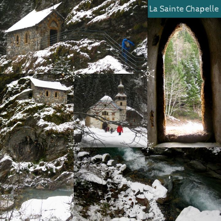
Don’t miss the extra 5mins hike from ⛪️ the church to see ⛪️ La Sainte-Chapelle:
🇫🇷🇨🇭 A little further afield
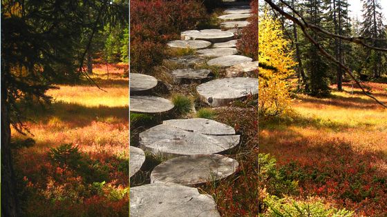
🇫🇷 Le Sentier des Arpelières (Crest-Voland Cohennoz)
I have hiked all over the world, but – hand on heart – 🍁🍂 the autumn colours and the magical nature of the peat bog terrain in the Réserve Naturelle of the Plateau du Lachat make this hike one of my all time favourites! We discovered this trail a couple of autumns ago, and we just loved it: 🍁 the autumn colours, the panels to read, the wooden passerelles to walk across . . . it is PERFECT! / more information here;
[ ⇒ to read about MBFF experience in autumn on this hike, see here ]
 @ montblancfamilyfun.com")
 @ montblancfamilyfun.com")
 @ montblancfamilyfun.com")


🇫🇷 Cirque de Sixt-Fer-à-Cheval (Sixt-Fer-à-Cheval, Haut Giffre)
The 🏞 Cirque de Sixt-Fer-à-Cheval is a stunning place to visit: a limestone amphitheatre made up of majestic mountains and numerous 💦 waterfalls (especially impressive during the spring melt), and there are some lovely family hikes to do here . . . the longer 🏞 Le Bout du Monde, the 💦 Cascade de Rouget, the 💦 Lac de Gers, or the very easy boucle de Frenalay (buggy-friendly, about 1 hour) or the boucle de Giffrenant. There is also the hike to the family-friendly 🏚 Refuge de Sales (1877m), with an overnight at the refuge guaranteed to please (you can download games for the children for this walk!). To find out more about the hiking options at 🏞 Cirque de Sixt-Fer-à-Cheval, then go to the Savoie Mont-Blanc website or the website Trace ta Route;
good to know – there is a 🧗♂️ via ferrata nearby, 💦 rafting on the Giffre river, the 🏞 Ancienne Gorges de Tines (another super family boucle!) and the nearby village Sixt-Fer-à-Cheval is classified as one of the Plus Beaux Village de la France! / at the cirque, there are: WC, gift shop & restaurant and pony rides in season.
🅿️ departure point & parking: Cirque de Sixt-Fer-à-Cheval /– entrance fee of 5€ / max altitude: depends on hike / distance: depends on hike;


 © mont-blancfamilyfun.com")
 © mont-blancfamilyfun.com")


Cirque du Sixt-Fer-à-Cheval (Boucle de Giffrenant) © mont-blancfamilyfun.com


🇨🇭 Bisse du Trient (Trient, Switzerland)
The hike along the 💦 Bisse du Trient (an irrigation channel dating from 1895, that brought water from the Glacier du Trient to the Col du Forclaz) is perfect for a family walk (an especially lovely walk with young hikers or elderly relatives not wanting anything too steep). We actually discovered this family walk one summer, thanks to the 🎶 music festival 🎵 CosmoJazz . . . Our children are no longer in buggies, but we did see people arriving with all-terrain buggies (we also saw people arriving with children on push bikes, which I would most definitely not recommend, as there is a steep fall down one side of the path!). The easy path follows the course of the 💦 Bisse du Trient, with a parcours ludique along the way, and at the end of the walk you are rewarded with a view of the Trient glacier and a buvette, 🥤 La Buvette du Glacier (you can picnic here, as long as you purchase refreshments) / NB – if small children are walking, it is imperative to hold their hand at all times, as there is a steep fall! / there was a significant landslide along this route over the winter season 2018, which rendered the path inaccessible for buggies, but for the summer 2019 it has been renovated with a new passerelle (quite bumpy terrain!);
🎵 Cosmojazz – the convivial walk along the Bisse du Trient to the Buvette du Glacier normally kicks off the festival!
🅿️ departure point & parking: Col de la Forclaz (Trient, Switzerland) / distance: 6,5km aller-retour / duration: 3 hours, with a lunch break;
[ ⇒ more information about this hike in MBFF article ]


🇨🇭 Les Gorges Mystérieuses de le Tete-Noire (Trient)
The MBFF tribe had driven past the starting point to the 💦 Gorges Mystérieuses de la Tête-Noire on numerous occasions, on our way to the 💦 Bisse du Trient family hike, or en-route to 🇨🇭 Martigny or the 💦 Bains de Saillon . . . but until a few summers ago, I hadn’t ventured any closer to this “ mysterious gorge ” . . . though I had certainly wondered what was so mysterious! And now I know! Mysterious and impressive indeed, the waterfall is a force of nature! It took the visit of my intrepid dad to spur me on with my quest and to venture forth (and after having already hiked to the Glacier du Trient and back, no less!). My boys have yet to learn much from their grandpa about hiking stamina!
The most direct hiking path is not long (30 mins down and 1h back up), but it is a steep descent (and therefore a steep return!), with a few ⛓ chains to help you on the tougher sections, so it is not for the faint-hearted! With small children, you do need to be vigilant, and especially down on the wooden viewing platforms, some of which weather damage from the elements each year!
[ ⇒ see MBFF article here for more details about this hike ]
🅿️ parking & departure point: 🅿️ parking de la Tête-Noire (Le Plan bus stop, 1929, Trient, Switzerland) / distance: 2,7km (direct aller-retour) / timing of direct hike & gorges visit: 2 hours (there are further hikes to do in the area / best time to visit: May until October (to be avoided after huge rainfall, as path and wooden walkways would be very slippery);


🇨🇭 Lac d’Emosson & dinosaur prints (Emosson dam, Switzerland)
I highlighted above a walk that takes you from Barberine up to the edge of the 💦 Lac d’Emosson (en-route to the 🏚 Loriaz huts). You can also drive straight to the 💦 Emosson dam and do a boucle around the new and old dams, taking in the impressive 🦕 dinosaur prints along the way (in the summertime, there are guided visits from experts). The 💦 Barrage d’Emosson is certainly worth a visit in itself – an immense hydroelectric dam, situated above the Franco-Swiss border;
good to know – you can sometimes have a guided visit of the inside structure of the dam!
🚃 Verticalp is the star attraction as far as vertiginous access to the dam goes! – from Châtelard (small village accessible by train from Chamonix), head by means of a very steep tramway up to the Barrage d’Emosson at 1965m – read about MBFF’s experience here;
🅿️ departure point & parking: 🅿️ Emosson dam (Switzerland) or Châtelard / train station: Châtelard / max altitude: 2600m (traces des dinosaures) / distance: different walks available / more information or here;


Tourist Office family hikes with activities
The Tourist Offices in the Pays du Mont-Blanc are excellent (and often overlooked, when we live in-situ!) resource centres when it comes to finding suitable family hikes. They have some 🗺 free maps and leaflets and sometimes 💰 treasure hunts / geo-caching options for family hikes (also available to download online).
Books and guides for hiking with children
Our local Tourist Offices here 🏔 au Pays du Mont-Blanc also have an excellent selection of 📚 guides, books and maps specifically aimed at hikes for families and young children in the area. We regularly use one of the four « Sentiers de Randonnées Pédestres au Pays du Mont-Blanc » (Belvédères du Mont-Blanc, Passy, Les Contamines-Montjoie and Chamonix Valley options) which come as booklets with a map (6€), and have a great selection of walks for families and very good instructions. We also have Guide de Randonnée Pedestre’s « 60 Promenades en Famille au Pays du Mont Blanc » (édition 2015); this excellent guidebook (10€) has a selection of sixty hikes selected by mountain guides and those responsible for the maintenance of mountain paths – it is divided into green (very easy, suitable for young children and never longer than 2h30), blue (medium difficulty) and red (difficult) walks.


I also happened across a wonderful little book for hiking with children au Pays du Mont-Blanc called 📚 « Les Sentiers d’Émilie au Pays du Mont-Blanc » by Jean-Pierre Hervet (RANDO Editions; 2008). There are 25 hikes listed in this edition; some of those listed are still a little long for our family at the moment, but we certainly hope to try them out in due time . . . Also recommended is 📚 « Le P’tit Crapahut » range of books (« Saint-Gervais, Megève, Sallanches » and « Chamonix »).


🥾 Bonnes Balades! I really hope you find some family hiking inspiration from this list of recommended hikes. Please do not hesitate to get in touch with your favourite family hikes (this list is not exhaustive; it is merely a handful of our favourite family hikes – up until now!).


What an awesome selection of hikes! Some tried and tested and some new to me. So many happy memories and a wish list for future adventures 🙂 Laura
LikeLike
Laura!!! I know, for me too, it brought back so many memories (my Chamonix family, before the little boys arrived to shake up “family life” and family walks!!!). Such fond, fond memories of the Loriaz Emosson walk (especially the bit at Emosson Dam, when Matt and I braved the September water, and you sat on the sidelines with your HOT tea!). And the Nepalese food and board games . . .
LikeLike